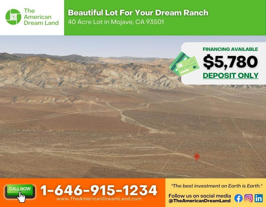
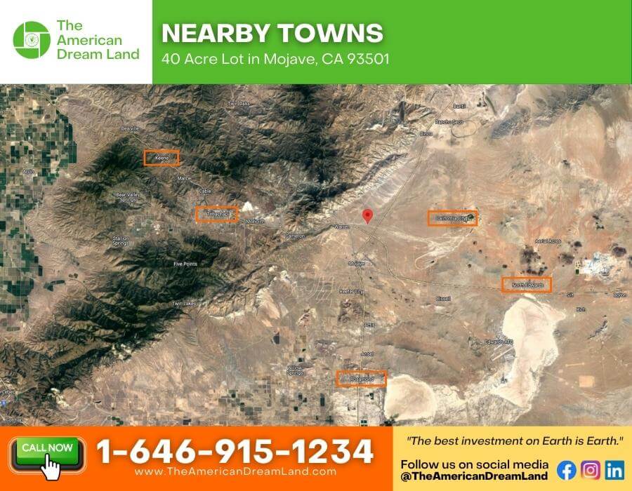
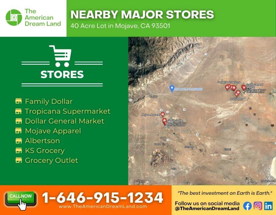
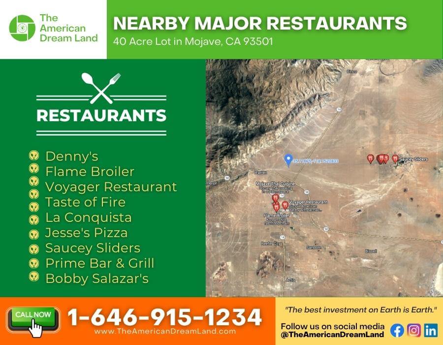
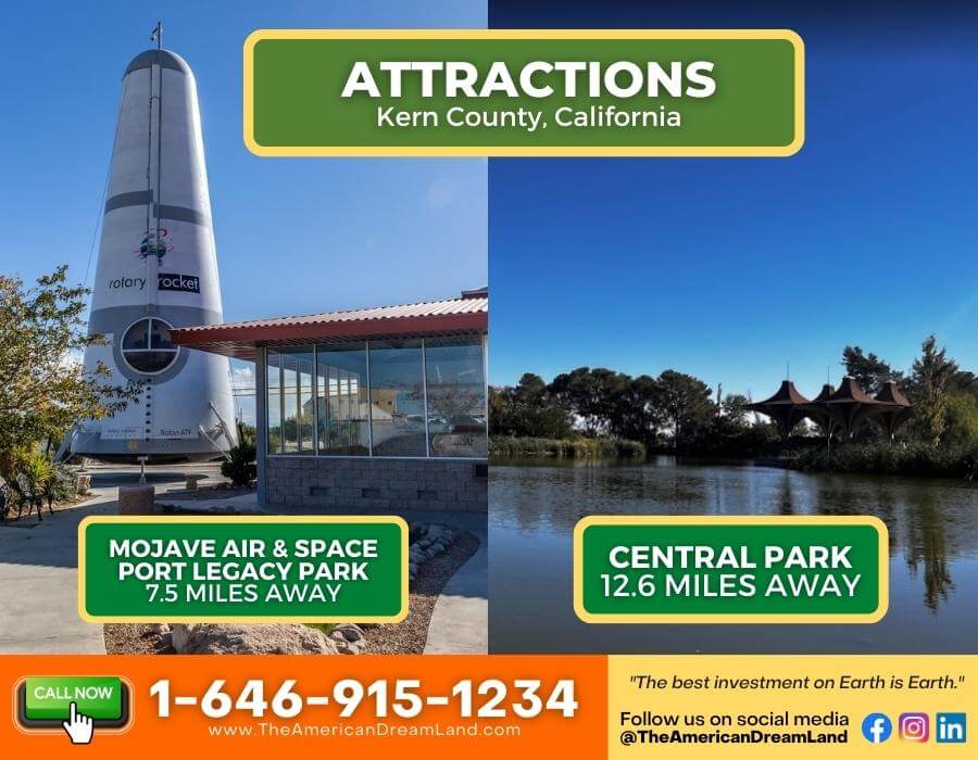
40 Acre Lot in Mojave, California
Payment Options
Description
Growing Kern County is excellent for investments or homes!
This 40-acre lot in Mojave, CA is perfect for making a long-term investment or building your dream home! Build your remote off-grid home or your recreational getaway place!
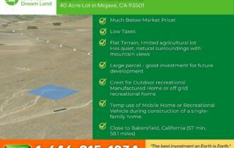
Why is this property a good investment?
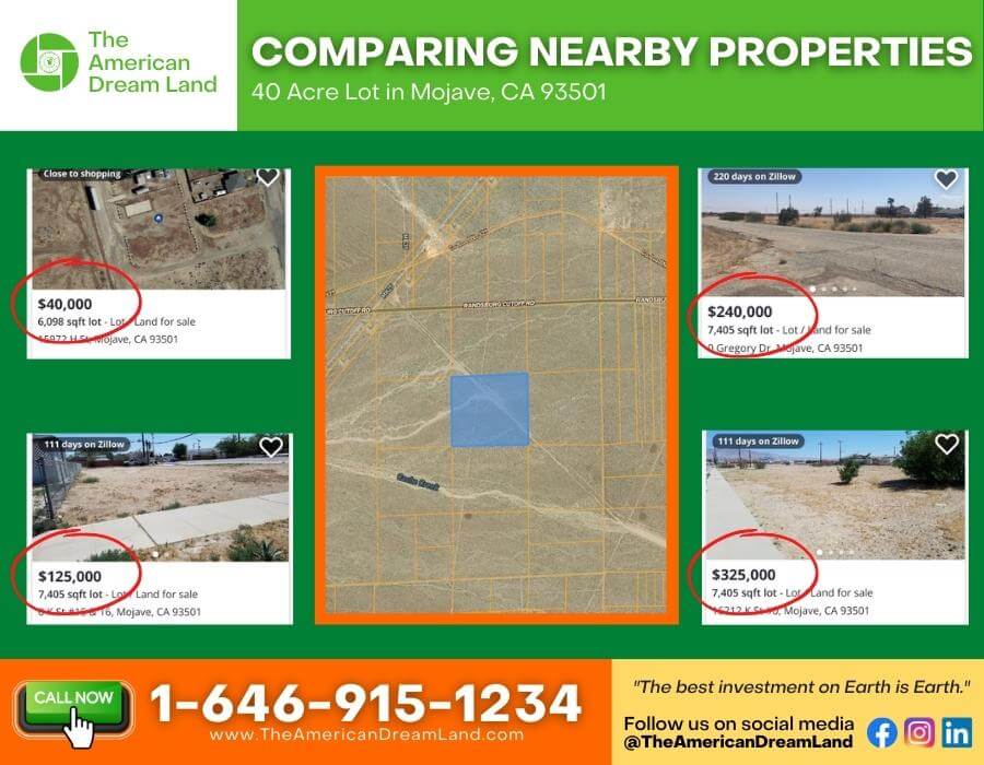
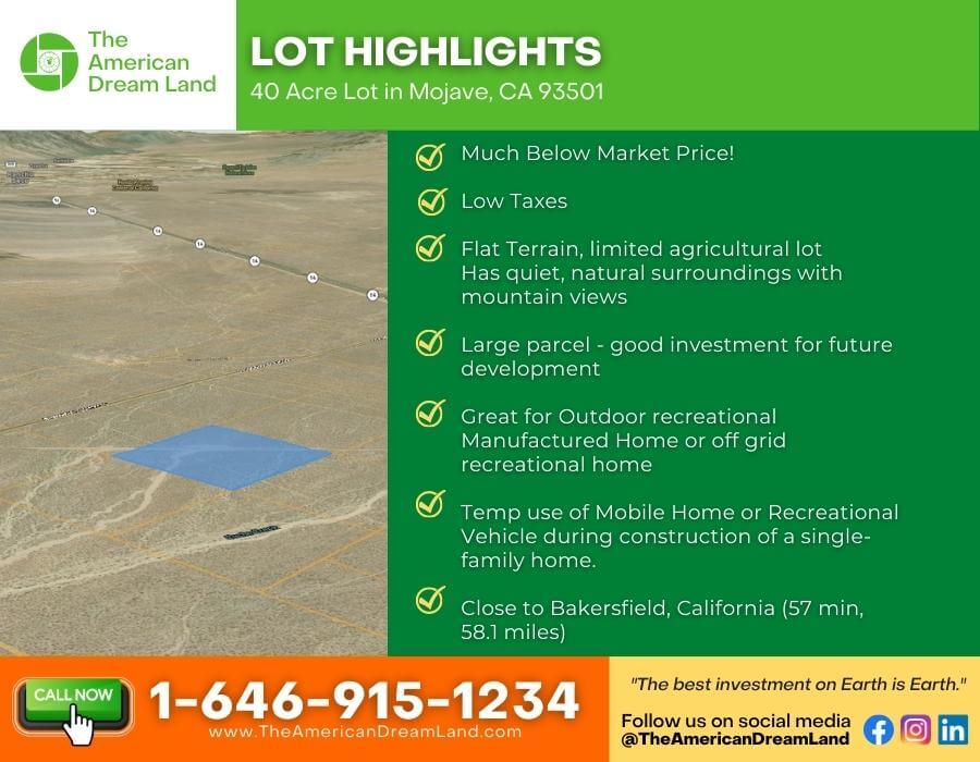
- Much Below Market Price!
- Low Taxes
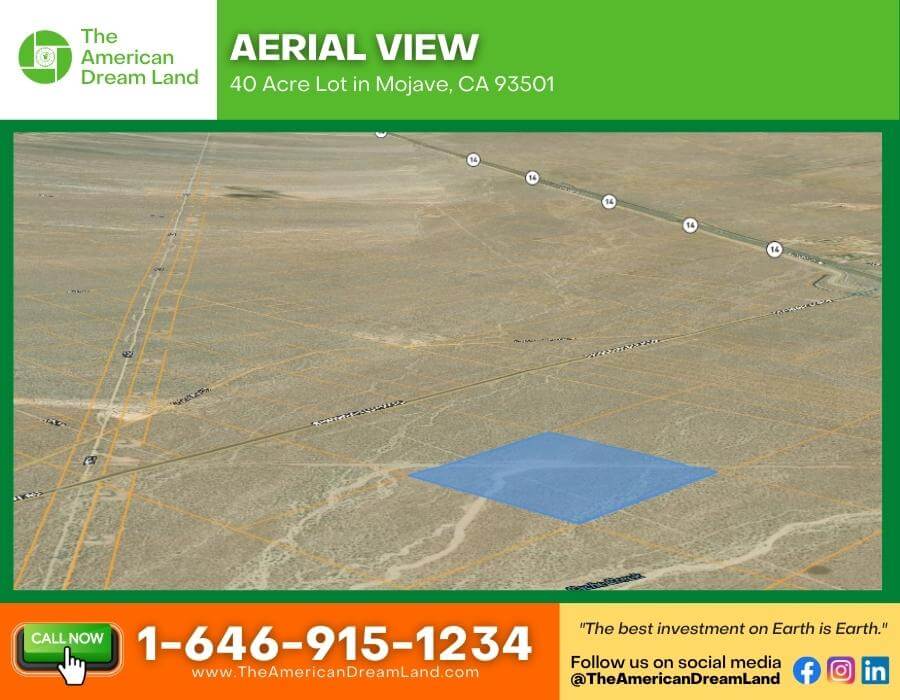
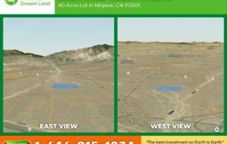
- Flat Terrain, limited agricultural lot
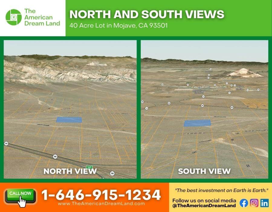
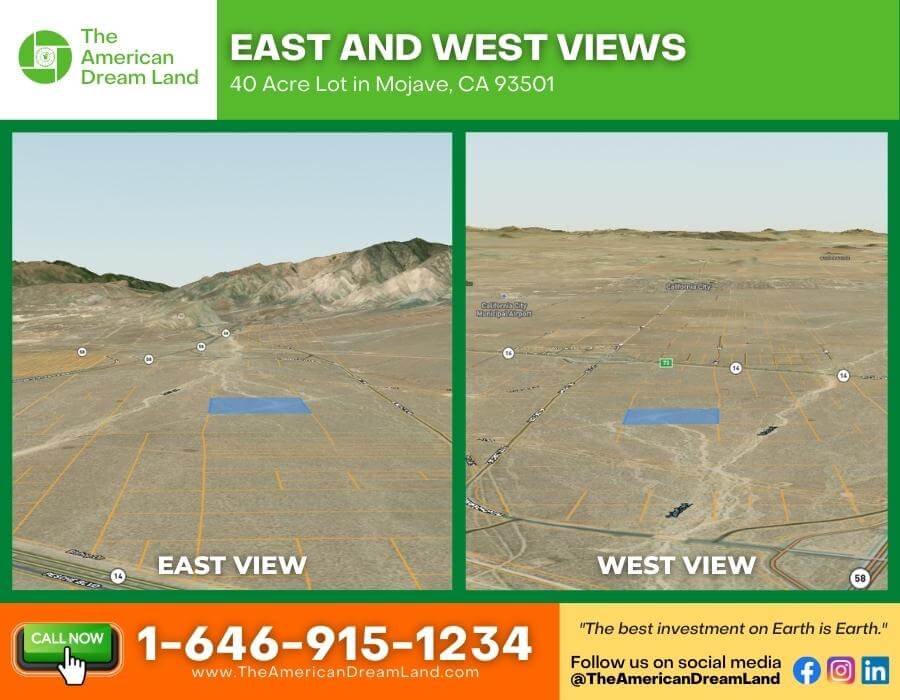
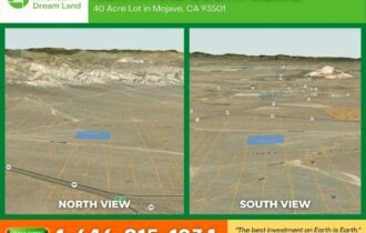
- Has quiet, natural surroundings with mountain views
- Large parcel – a good investment for future development
- Great for Outdoor recreational
- Manufactured Home or off-grid recreational home
- Temp use of Mobile Home or Recreational Vehicle during construction of a single-family home.
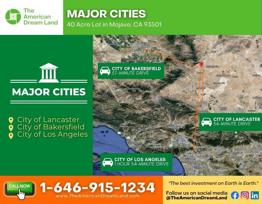
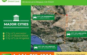
- Close to Bakersfield, California (57 min, 58.1 miles)
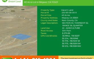
Property Details:
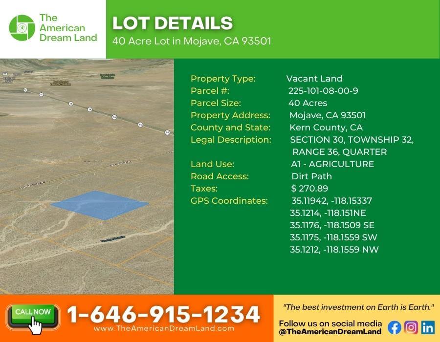
- Property Type: Vacant Land
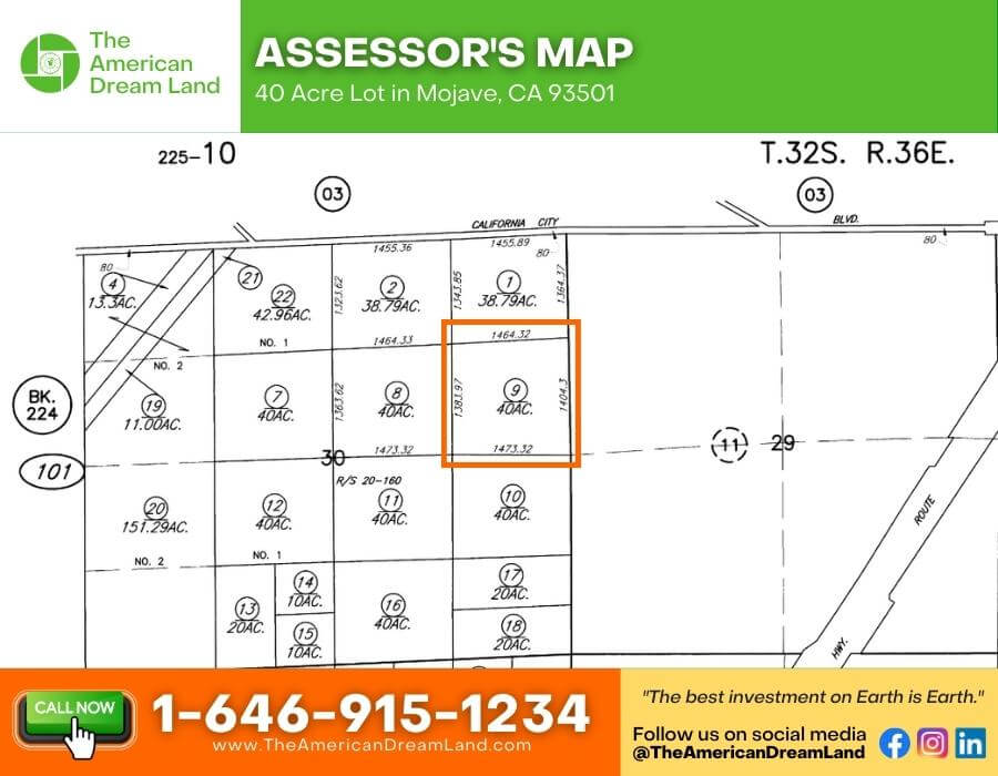
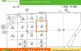
- Parcel #: 225-101-08-00-9
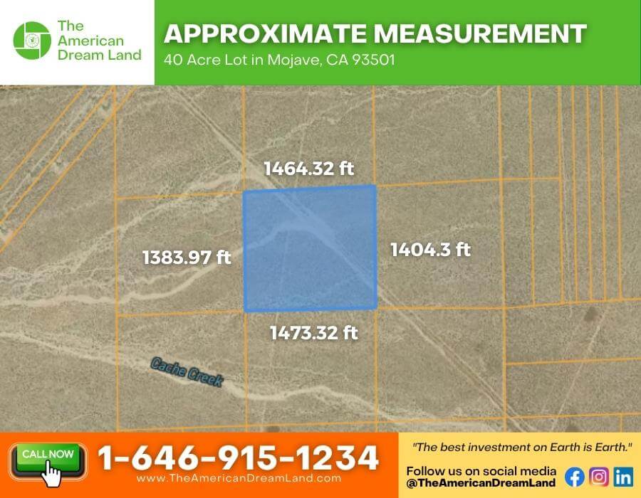
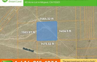
- Parcel Size: 40 acres
- Property Address: Mojave, CA 93501
- County and State: Kern County, CA
- Legal Description: SECTION 30, TOWNSHIP 32, RANGE 36, QUARTER
- Land Use: LIMITED AGRICULTURE (A-1)
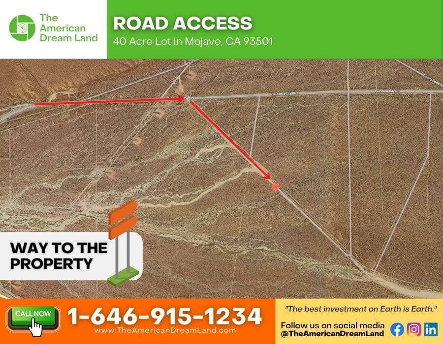
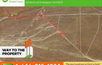
- Road Access: Dirt Path
- Utilities: All utilities will need to be brought to the lot.
- Annual Taxes: $ 284.43 approximately
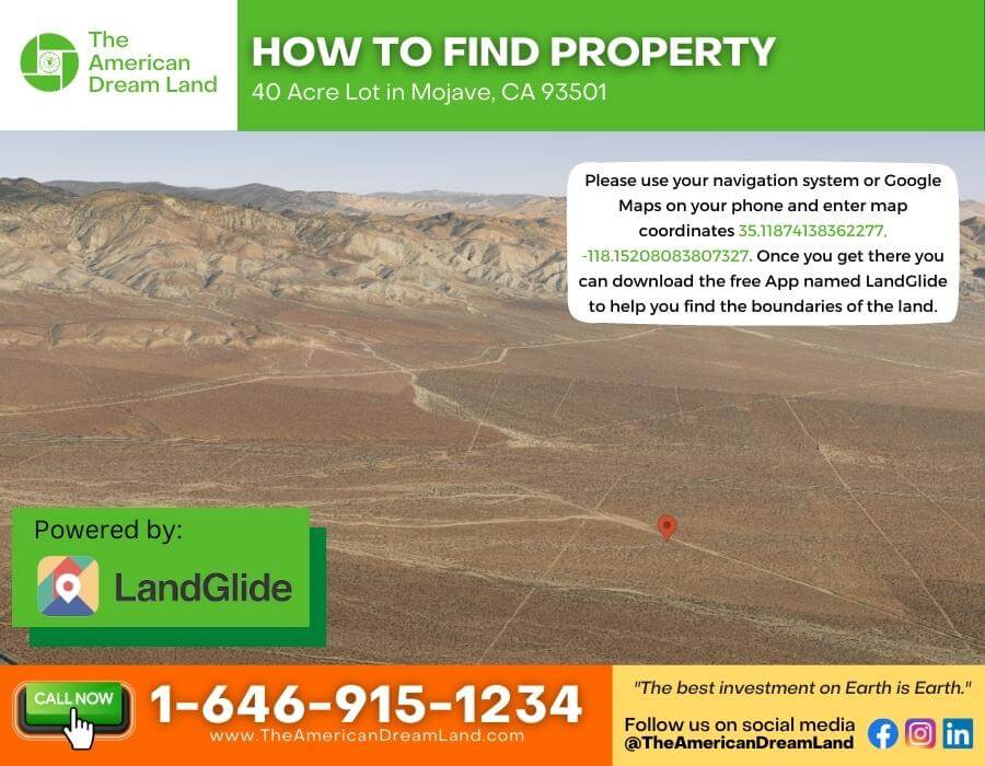
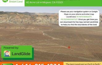
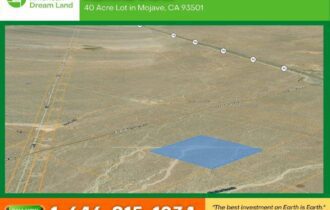
- GPS Coordinates: 35.11942, -118.15337
35.1214, -118.151NE
35.1176, -118.1509 SE
35.1175, -118.1559 SW
35.1212, -118.1559 NW
- Google Map link: https://goo.gl/maps/guA8hj8earvgZxBC9
We provide wholesale discounts on all of our real estate sales! We’ll work with you to find the property of your dreams! We also offer flexible financing options.
Call us now at 1-646-915-1234 or send an email to [email protected] to discuss more!
NOTE: Buyer responsible for own due diligence regarding property, it’s use codes, obtaining permits, connecting utilities, and any other future plans the buyer can conceive. Land is sold as-is, where-is with buyer paying all closing costs. Price based on an all-cash purchase.
Property Features
Acres
38
Access
Dirt Path
Coordinates
35.11942, -118.15337
Zoning
Limited Agriculture (A-1)
Purchase Information/Fees
$270.89/year
Annual Tax
Nearby Attractions/City
Death Valley
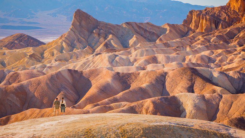
Death Valley National Park is an American national park that straddles the California–Nevada border, east of the Sierra Nevada. The park boundaries include Death Valley, the northern section of Panamint Valley, the southern section of Eureka Valley and most of Saline Valley. The park occupies an interface zone between the arid Great Basin and Mojave deserts, protecting the northwest corner of the Mojave Desert and its diverse environment of salt-flats, sand dunes, badlands, valleys, canyons and mountains. Death Valley is the largest national park in the contiguous United States, as well as the hottest, driest and lowest of all the national parks in the United States.[5] It contains Badwater Basin, the second-lowest point in the Western Hemisphere and lowest in North America at 282 feet (86 m) below sea level. More than 93% of the park is a designated wilderness area.[6] The park is home to many species of plants and animals that have adapted to this harsh desert environment including creosote bush, Joshua tree, bighorn sheep, coyote, and the endangered Death Valley pupfish, a survivor from much wetter times. UNESCO included Death Valley as the principal feature of its Mojave and Colorado Deserts Biosphere Reserve in 1984.